Certosa di Calci
Diagnostic studies and research for the conservation and enhancement of the Certosa di Calci and its Museum Poles
The University of Pisa, through a large consortium of its departments, has activated a large conservation and enhancement program of the “Certosa di Calci” complex and its museum poles (coordinated by M. G. Bevilacqua).
The MAPPA Laboratory focused on the Verification of the Archaeological Impact (VIArch) and on the collection and management of all the archaeological data of the Municipality of Calci.
In this perspective, a series of stratigraphic, georadar and geognostic investigations was carried out in order to acquire new data on the Certosa Complex.
Verification of the Archaeological Impact (VIArch)
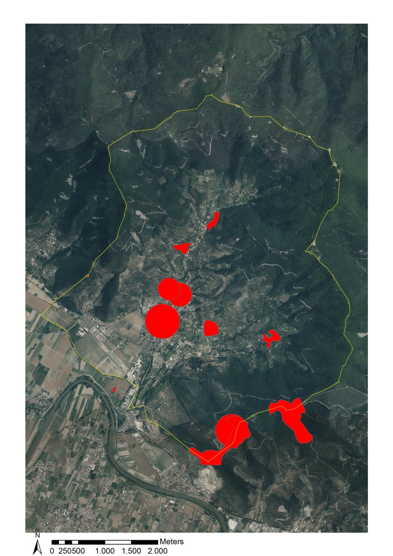
The first part of the project aimed at achieving an exhaustive archaeological framework, in order to define the degree of impact on the archaeological heritage in the Certosa area and to compile the Verification of Archaeological Impact (VIArch). The published archaeological data and the archival documentation of the whole territory of Calci have been digitized and properly stored in a relational database linked to a GIS. This knowledge framework was integrated with aerial photo anomalies related to the buried archaeological heritage.
The acquisition of published and archival sources (located in the ABAP Superintendence) has shown a rather fragmentary archaeological knowledge both in the Certosa and in the whole Calci municipality: many random findings attest the long life continuity of the human settlement from prehistory to contemporary times, but only two sites have been systematically excavated.
During the second phase, together with the archaeological analysis and the study of the construction phases of the Certosa, some areas of great interest have been chosen as the subject of geophysical and stratigraphic investigations to go in-depth into specific historical-archaeological issues.
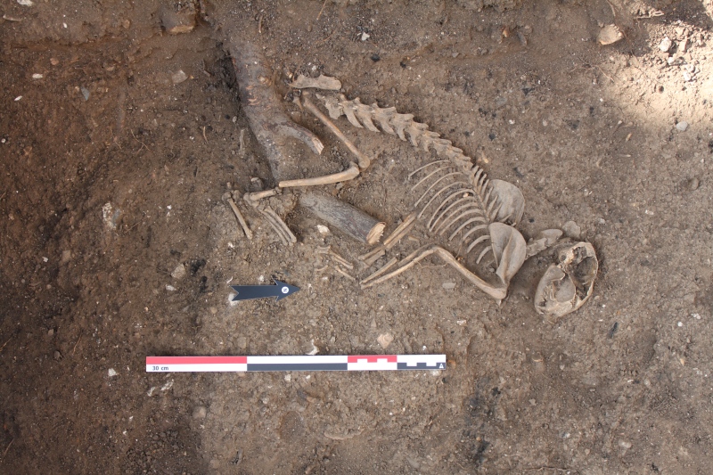
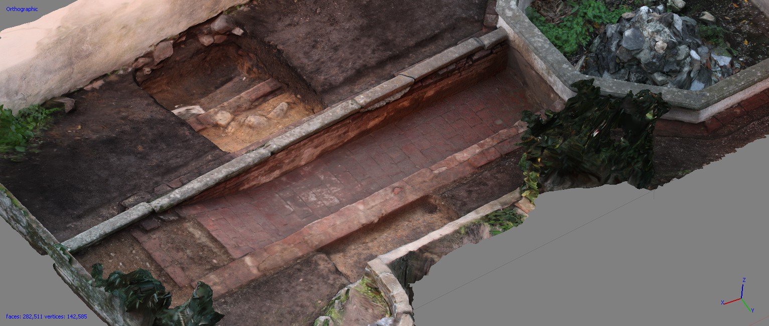
In this perspective, nine shovel tests were carried out and the sections exposed in the drain channels in the gardens outside the Certosa building were archaeologically read, showing traces of agricultural frequentation dating from the 14th / 15th century to the 19th century.
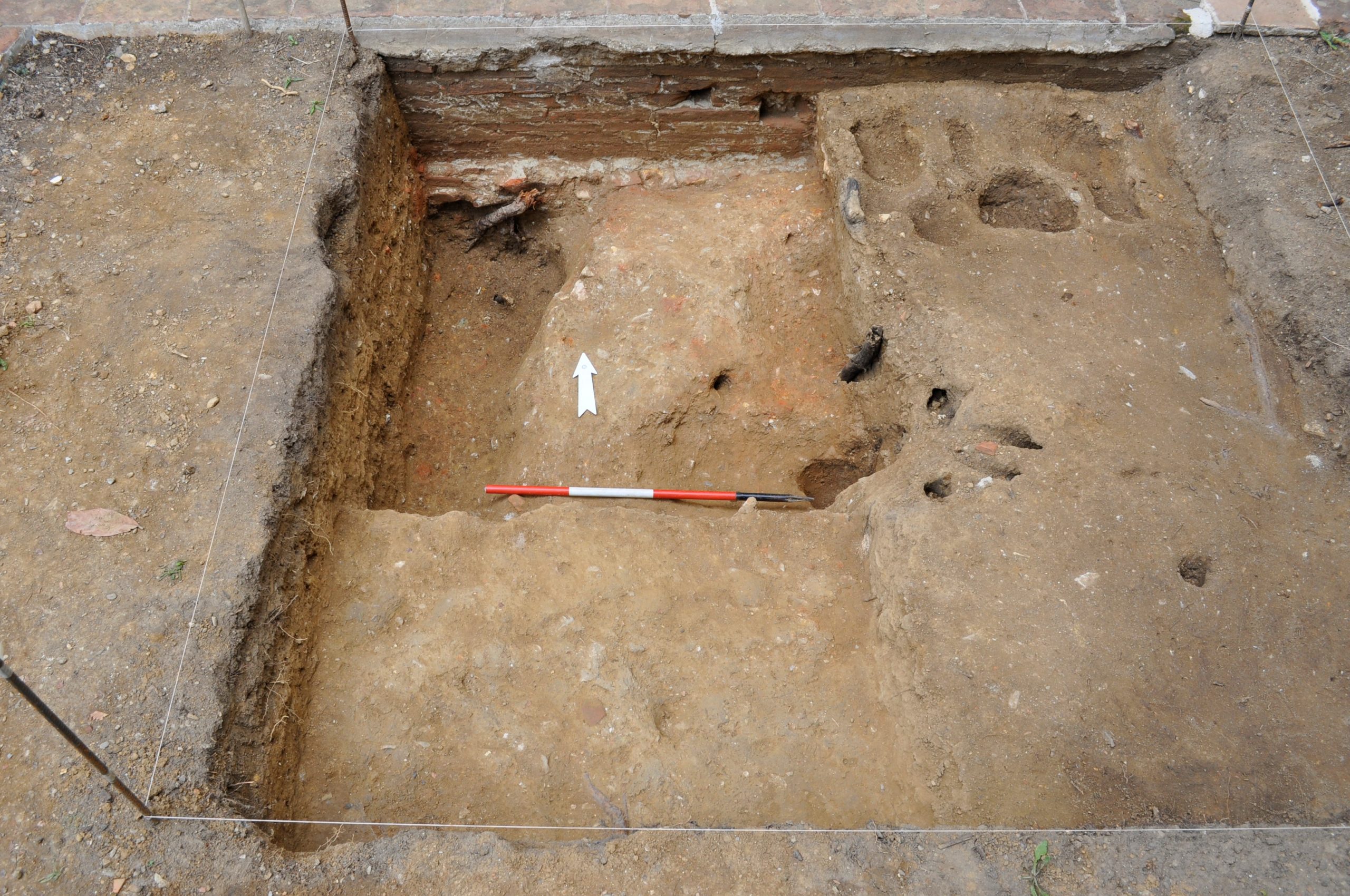
Archaeological excavation and Garden Archeology
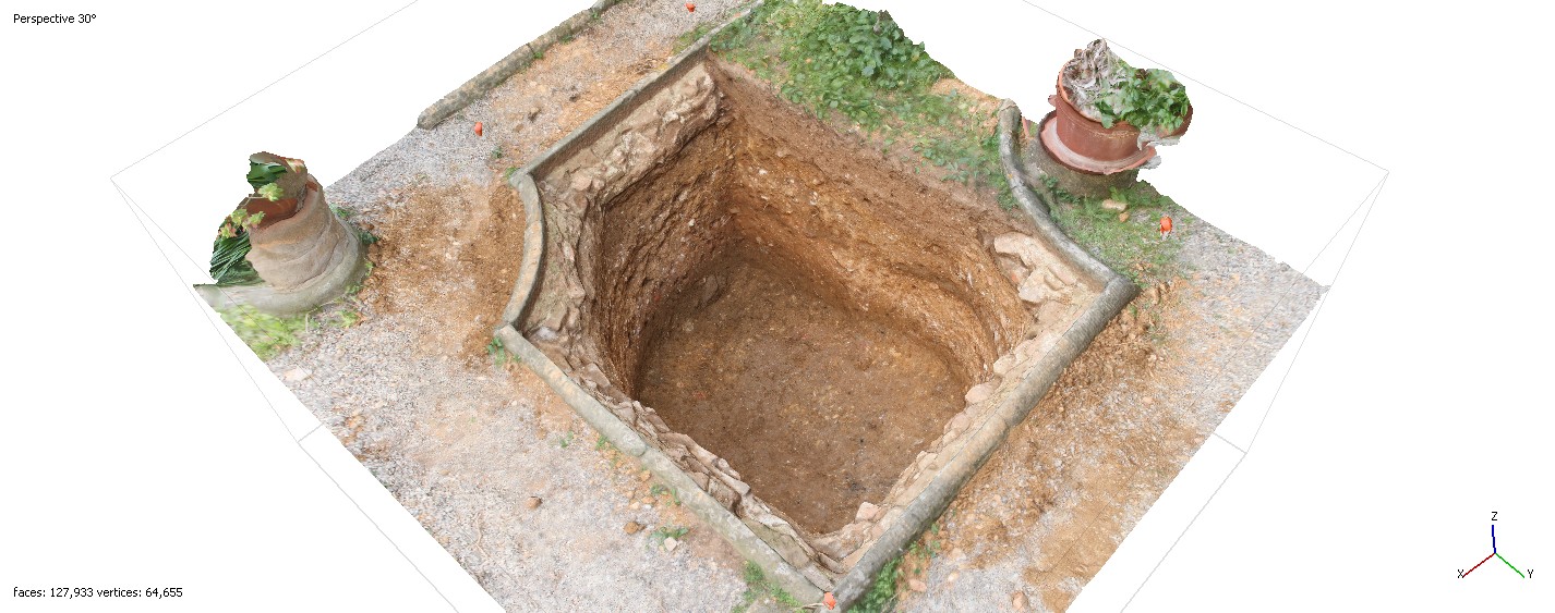
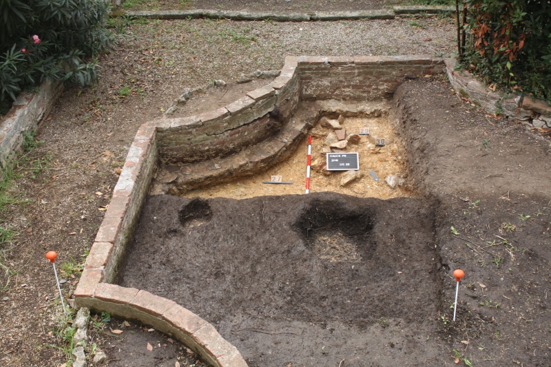
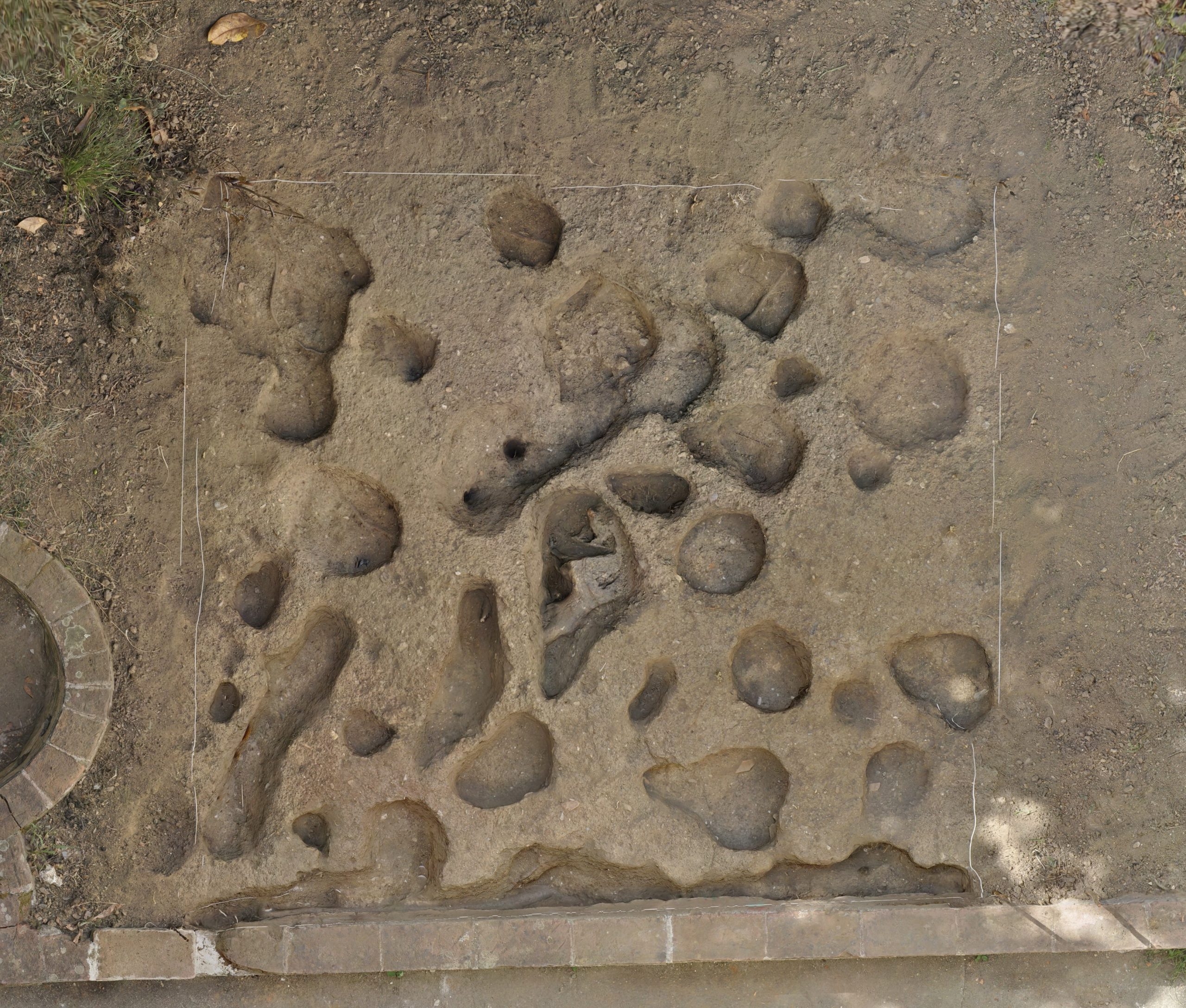
Garden Archaeology is a particular branch of landscape archaeology focused on the study of limited size and strongly anthropized areas. As part of the project, stratigraphic investigations in the friars’ cell gardens are currently ongoing. These investigations aim to reconstruct the farming activities in the various phases of the gardens, the structures necessary to design the gardens and the phases before the visible ones. One of the excavated gardens is the garden of the Prior’s cell, built in 1375, and renovated several times until the late 18th century. In its present appearance, the Prior’s garden is organized into two levels connected by a staircase. Orthogonal paths divided by four small flowerbeds mark the upper terrace, facing the loggia. At the time of its construction, the articulation in paths and flowerbeds provided for a perfect symmetry between the eastern and western halves of the garden; this was partially compromised in 1825 by the extension of the building necessary for the consolidation of the adjacent library. The presence of two flowerbeds and a grotesque backdrop framing an octagonal basin with a fountain characterizes the lower terrace. Along the boundary walls runs a flowerbed where climbing plants, aromatic herbs and espalier citrus were cultivated.
The excavation brought to light the structures that characterize the gardens in modern times and allowed to gather the first archaeobotanical and pollen data on the plants cultivated in the past.
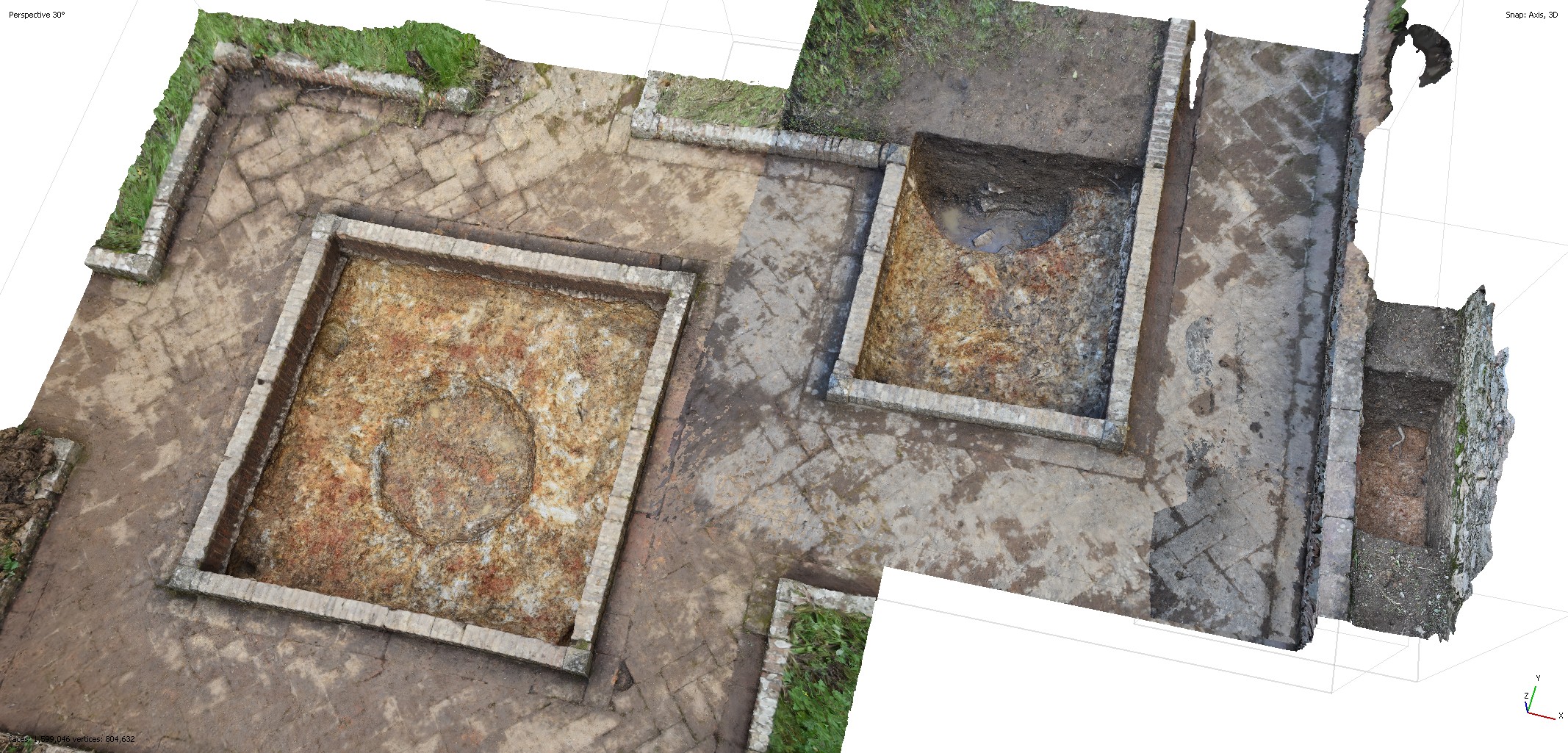
Between 2019 and 2021, new investigations have been carried on. Recent excavations have been realised on Padre Maestro and Speziale’s gardens and in the yard called “Monti Pisani”. Moreover, also the external area of the orchard has been investigated. Archaeological, archaeobotanical and pollen data are being studied.
Geognostic investigations
In coordination with the Department of Engineering and with the Department of Geology of the University of Pisa, five cores were carried out within the boundaries of the Certosa. The archaeological reading has allowed acquiring punctual stratigraphic data on the anthropic frequentations of late-medieval, modern and contemporary ages in the agricultural land that surrounds the building.
Geophysical surveys
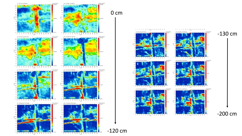
The archival research carried out during the first phase had contributed to the definition of potential areas of intervention within the Certosa complex. A planimetric layout kept in the Certosa Archive draws attention to the Cortile d’Onore where the presence of “ancient walls and substructures” was reported. These traces, georeferenced in a GIS and placed on the plan of the Certosa of 1688 (ASPi, Inventory n. 14, 209), had proved to be compatible with the original perimeter of the Cortile d’Onore, enlarged only at the end of the XVIII century. Therefore, three geophysical surveys have been conducted (by A. Ribolini) in order to evaluate the real consistency of these traces and to verify the presence of further buried elements.

Project by:
Gabriele Gattiglia gabriele.gattiglia@unipi.it
M.Letizia Gualandi letizia.gualandi@unipi.it
Antonio Campus a.campus11@gmail.com
Francesca Anichini francesca.anichini@unipi.it